World War One Sites - The NETWORLD Database
Trail of Peace / Karnischer Höhenweg in the Carnic Alps, East Tyrol and Carinthia, Austria
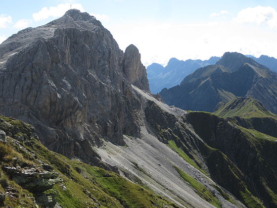
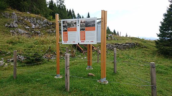
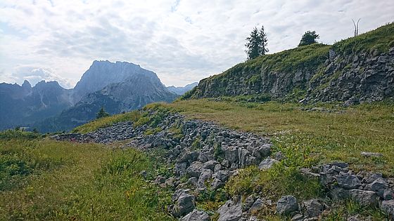
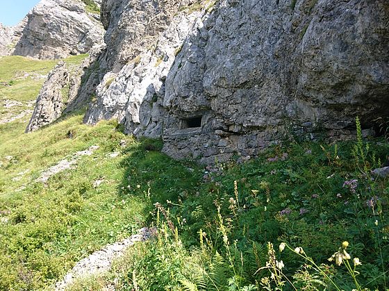
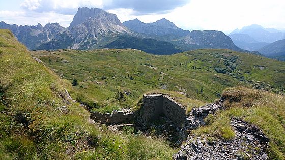
Along the Trail of Peace ("Via della Pace" or Karnischer Höhenweg), many archaeological traces from World War One can be found. The remains are in different conditions and some of the sites are already heritage-protected.
The Trails of Peace were initiated by the Austrian Dolomitenfreunde association with the aim of making former World War One tracks across the front accessible again and conserving the heritage of the war in this region.
Austria, East-Tyrol, Carinthia
Type of WWI-heritage
- Trench-system
- Military Fortification
- Military Infrastructure
- Military cemetery
- War monument
Dimensions
The Trail of Peace in the Carnic Alps, known in German as Karnischer Höhenweg (No. 403) passes through the federal counties of East Tyrol and Carinthia. It follows the Karnischer Kamm and stretches along a route of around 150 kilometres, mostly at a height of 2,000 metres above sea level.
State of repair/preservation
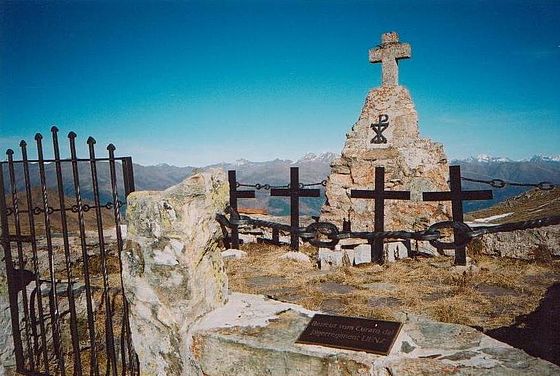
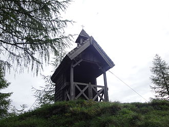
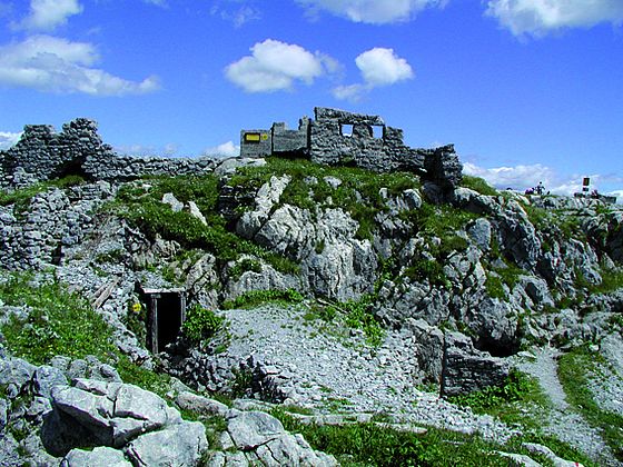
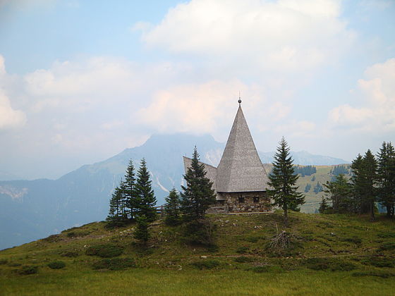
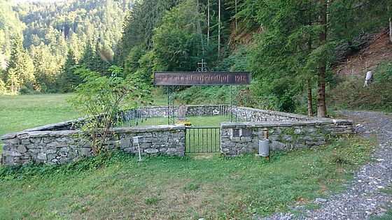
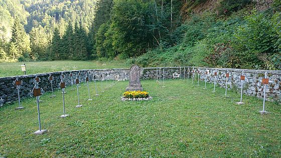
The archaeological remains from World War One along the Karnischer Kamm are in different states of upkeep. The Hochgränten war cemetery in Eastern Tyrol is in relatively good condition – as is the Prinz-Heinrich memorial chapel nearby, the chapel near to Zollnersee and the remains of fortifications on Kleiner Pal, situated near the Plöckenpass/Passo di Mt. Croce Carnico (1,357 m). The "Open-Air Museum of the Mountain War 1915–1917" is also located on Kleiner Pal, constructed and administered by the Dolomitenfreunde association. Other remnants on the other hand have almost vanished, for example communication and gunnery trenches, caverns, terraces upon which the Austro-Hungarian troops built barracks in World War One, an artillery observation post and the remains of stone walls with dry masonry construction.
Historical WWI Context
The Karnischer Kamm formed a section of the so-called Southwestern Front – the front situated between Austria-Hungary and Italy from May 1915 onwards. It stretched over a length of around 600 kilometres in a linear distance from the Swiss border to the Adriatic coast. In East Tyrol the front stretched approximately 115 kilometres from the national border between Tyrol and Carinthia at the height of the settlement of Maria Luggau to Carinthia/Mt. Nero (2,244 m).
Italian, Austro-Hungarian and German soldiers faced each other on this part of the front mainly between 1915 and 1918, primarily in high-Alpine terrain and usually at an altitude of 2,000 to 3,900 metres above sea level. In 1915, soldiers on both sides initially had to make the complete terrain suitable for military operations. Apart from a few mountains made accessible for tourists and trails used by the local population in summer for cattle driving, hardly any well-developed paths or tracks existed between the Ortler (3,899 m) near to the Swiss border and the Julian Alps.
Between 1915 and 1917 soldiers fighting along this section of the front had to defend their homeland under extremely adverse conditions. Many died – not just from the fighting itself but also due to frostbite because of the extreme weather conditions or due to avalanches.
Recent Images
Historical Images
State of legal protection
Only the Hochgränten military cemetery is heritage-protected. As part of a project concluded in 2017, the archaeological remains of World War One in the area of Obstanser See (borough of Kartitsch) were placed under protection.
Owner
Some of the sites are privately owned or owned by mountain pasture communities.
Kind of cultural use of WWI
The Trails of peace (“Vie del Pace”) were initiated by the Austrian Dolomitenfreunde association with the aim of making former World War I tracks across the front once again accessible and conserving the heritage of the war in this region.
The Karnische Höhenweg (No. 403) can be wandered along between the Sillianer Hütte in Eastern Tyrol and Arnoldstein in Carinthia.
Further information: www.karnischer-hoehenweg.at
The “Freilichtmuseum des Gebirgskrieges 1915–1917"” on the Plöckenpass is situated along the Karnische Höhenweg hiking trail. Access is free. For special occasions, the Dolomitenfreunde association also offers organised walking tours in the open-air museum.
Further information: www.dolomitenfreunde.at
Entry must be paid to the “Museum 1915–18. From the Ortler to the Adriatic Coast” in Kötschach-Mauthen that focuses on the history of World War I in the mountains.
Soldiers' routs (SoldatenWege Rattendorfer Alm) in the area of Rattendorfer Alm: https://www.facebook.com/SoldatenWege-Rattendorfer-Alm-329074090768790/
Opening
“Museum 1915–18. Vom Ortler bis zur Adria” (From the Ortler to the Adriatic Coast), Kötschach-Mauthen Season runs from 15 May – 15 October Visits by groups are also possible with appropriate pre-registration outside of opening times.
|
Entrance Fee
The Trail of Peace / Karnischer Höhenweg can be freely accessed. Along the hiking trail, mountain huts managed by the Austrian Alpine Association offer opportunities for stopping.
Information regarding cities, villages, other touristic attractions (non-WWI) nearby
Further information:
Mountain climbers villages: www.bergsteigerdoerfer.at
Karnischer Höhenweg: www.karnischer-hoehenweg.at
Lesachtal: www.lesachtal.com
Marktgemeinde Kötschach-Mauthen: www.koemau.com
Region Karnische Alpen: www.karnische-alpen.com
Region Nassfeld-Pressegger See: www.nassfeld.at
Accomodation
Further information:
Mountain climbers villages: www.bergsteigerdoerfer.at
Gemeinde Kartitsch: http://www.kartitsch.at/
Karnischer Höhenweg: www.karnischer-hoehenweg.at
Lesachtal: www.lesachtal.com
Region Karnische Alpen: www.karnische-alpen.com
Region Nassfeld-Pressegger See: www.nassfeld.at
Public Transport
Further information:
ÖBB: www.oebb.at
Further information sources
Publications:
Österreichisches Schwarzes Kreuz (Hg.), Kriegsgräberfürsorge. Dokumentation, Wien (2012).
Gabriele & Walther Schaumann, Unterwegs vom Pustertal zum Plöckenpass. Auf den Spuren der Karnischen Front 1915–1917, Klagenfurt (2003).
Gabriele & Walther Schaumann, Unterwegs vom Plöckenpass zum Kanaltal. Auf den Spuren der Karnischen Front 1915–1917, Klagenfurt (2004).
Gabriele & Walther Schaumann, Unterwegs zwischen Save und Soča. Auf den Spuren der Isonzofront 1915–1917, Klagenfurt (2005).
Christian Terzer, Frontstellungen im Hochgebirge. Das Projekt Karnischer Kamm, in: Ort – Erinnerung – Denkmal. Relikte des Ersten Weltkriegs. Österreichische Zeitschrift für Kunst und Denkmalpflege, Heft 3/4 (2015), S. 262–271.
Julia Walleczek-Fritz & Peter Fritz, Begehen-Begreifen-Bewahren. Der Erste Weltkrieg entlang des Karnischen Kamms zwischen Sexten und Plöckenpass, Kartitsch/Sexten (2015).
[English Version: Julia Walleczek-Fritz & Peter Fritz: Ascend-Apprehend-Aspire. The First World War along Carnic Ridge between Sexten and Plöckenpass, Kartitsch/Sexten (2015).]
Ludwig Wiedemayr, Weltkriegsschauplatz Osttirol. Die Gemeinden an der Karnischen Front im östlichen Pustertal, Lienz (2007).
Other heritage sites nearby
- Austro-Hungarian Military cemetery Hochgränten, East Tyrol, Austria
- Open-Air Museum of the Mountain War 1915–1917, Plöckenpass, Carinthia, Austria
- Memorial Church of Holly Spirit on Javorca, Slovenia
- Austro-Hungarian Military Cemetery Log pod Mangartom, Slovenia
- Prinz-Heinrich Memorial chapel, East Tyrol, Austria
- Chapel of Peace at Zollnersee, Carinthia, Austria
- Austro-Hungarian Military cemetery Kreuztratte, Plöckenpass, Carinthia, Austria
Museums Private Collections
“Museum 1915–18. Vom Ortler bis zur Adria” [Museum 1915–18. From the Ortler to the Adriatic Coast], Kötschach-Mauthen (Carinthia)
“Open-Air Museum of the Mountain War 1915–1917”, the Plöckenpass
Museum and open-air museum were established by the Austrian “Dolomitenfreunde” association which continues to support these until the present day.
Further information: www.dolomitenfreunde.at
Trail of Peace / Karnischer Höhenweg in the Carnic Alps, East Tyrol and Carinthia, Austria
46.64251899509222 12.795616837231478 fileadmin/res/images/layout/standar-marker.pngLocation